Project overview
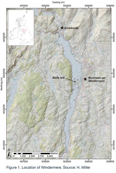
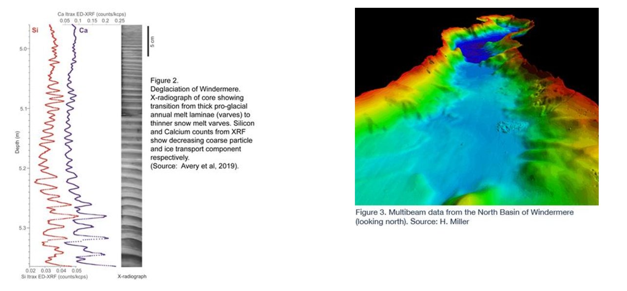
The University of Southampton has over 15 years of experience in investigating and analysing the lake bed and sub-surface sediments of Windermere, England’s largest natural lake. NERC funded research, much of it in collaboration with BGS, has facilitated the acquisition and analysis of several high resolution data sets that provide key insights into the lake bed environments, the subsurface structures and the sedimentary record. This has enabled the reconstruction of the history of environmental change over the last 20,000 years ranging from the last deglaciation of the Lake District through to anthropogenically driven lake pollution and eutrophication.
Research by the University of Southampton and partners has been driven by five collaboratively supervised PhD investigations and associated complementary Masters Projects. Initial research targeted the subsurface sediment structure. These investigations, complemented by subsequent work on the lake floor bathymetry, environments and surface sediments, paved the way for a comprehensive coring program designed to recover the past 20,000 years history of lake evolution. This spans a period from the last Glacial Maximum via the climatically highly variable deglaciation, through the Holocene to the most recent period of increased human impact on the lake. Publication of the results of these studies is ongoing, as is monitoring of the most recent sedimentary records of lake pollution and eutrophication.
Methodology

Seismic Surveys
University of Southampton surveys 2007-2008. Over 150 km of high resolution multichannel seismic reflection profiles along intersecting lines were taken with a Boomer source and 60 m 60 channel streamer covering the entire lake basin. These were augmented by localised 3D seismic imaging.
Multibeam
BGS survey 2010 on R/V White Ribbon, 100% coverage to 5m water depth
Sediment samples
74 samples from 2011, 29 samples from 2012. Analysis of sub-samples: grain size analysis, scanning electron microscopy, XRF and total organic carbon.
Underwater Video
BGS and CEH ROV's used to investigate lake bed environments
Sediment Coring
8 piston cores (max length 10m) and 9 gravity cores (max length 2m) were acquired in 2012. Cores run through MSCL, split and logged. Further analysis using ITRAX, XRF, 137Cs and 210Pb dating. The piston cores have also been dated by radiocarbon and undergone palaeomagnetic analysis. Additional short gravity cores from reference locations in the North and South Basins, also recovering the sediment-water interface, were taken in 2014, 2018 and 2019. The cores have been resin-embedded and sediment fabrics and mineralogy analysed by optical microscopy and Scanning Electron Microscopy (SEM) including energy dispersive X-ray microanalysis.

Lakebed and Sediments
The morphology of the lake bed is divided into several sub-basins, characterised by a number of ridges, steps, exposed bedrock, plateaus and isolated topographic highs. These glacial geomorphological features relate to the most recent Devensian glaciation. A number of submerged mass movements and features formed by human activities represent currently active sedimentary processes. Several lake bed environments have been identified, with a fine detrital mud covering >95% of the lake bed. The fine detrital mud represents most recent Holocene sedimentation derived from the catchment.
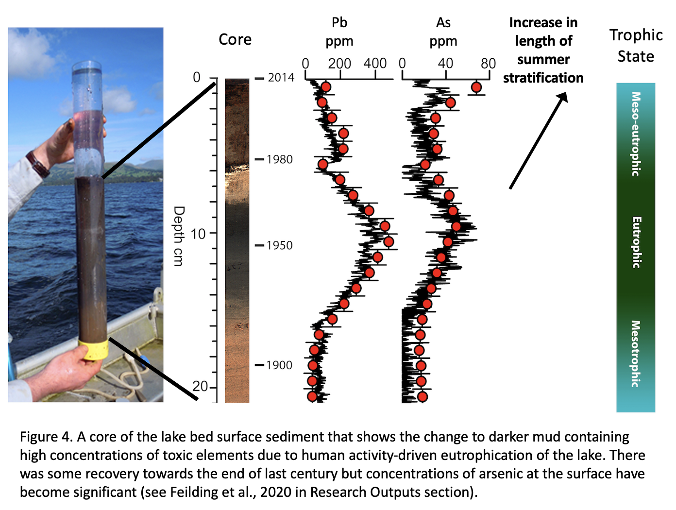
Analysis of sediments from the last 200 years shows that Windermere underwent eutrophication due to increased human activity, leading to increased concentrations of potentially toxic elements in the lake sediment including lead, mercury and arsenic. Lake remediation schemes, including improvements in sewage treatment, have led to a partial recovery, but current climatic warming trends are contributing to renewed concentrations of toxic elements in the surface sediments (Figure 4 and Fielding et al., 2020).

PhDs and Other Opportunities
Visit GSNOCS
Related pages
The British Geological Survey surveys Lake Windermere


